Professional Observation
Basic Information
Observation Details
Observation Date:
December 2, 2022Submitted:
December 3, 2022Observer:
PAC - George HalcomZone or Region:
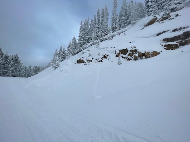
Brundage Out of BoundsLocation:
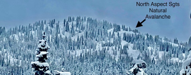
SGT's North of Brundage MtnSigns of Unstable Snow
Recent Avalanches?
YesCracking?
WidespreadCollapsing?
None ExperiencedSnow Stability
Stability Rating:
PoorConfidence in Rating:
ModerateStability Trend:
WorseningBottom Line
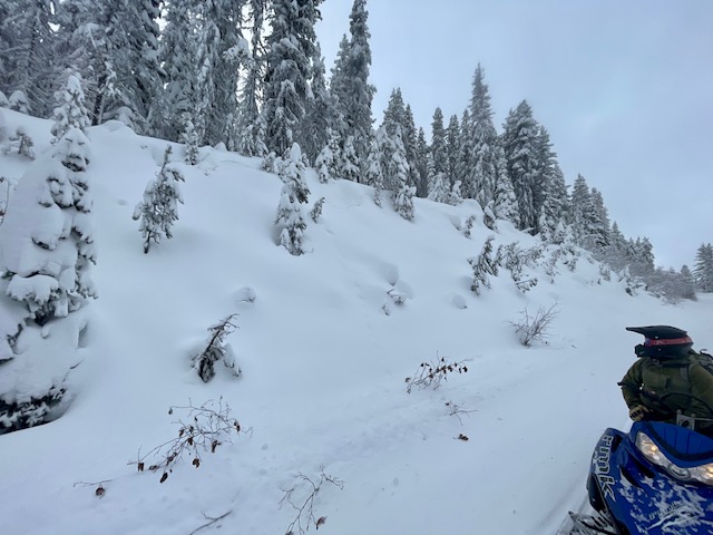
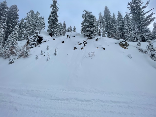
Settling snow this week cold form more sensitive slabs over weak snow...This past week was a heck of an event! We doubled our snowpack. 3 feet of snow and Strong South wind created a widespread natural avalanche event that crushed and flushed our rotten snowpack in the majority of our steep terrain. Some areas may still have a 3-6 ft slab just waiting for a human trigger. Northern and eastern terrain saw the majority of wind loading or slab development. Coverage from this event was great, but the weak snow near the ground, especially in rocky terrain, the snow is gone in most places that are steeper than 35 degrees. We saw a lot of steep North terrain Friday that had obviously slid (many D3-sized Avalanches big enough to bury a car or break trees) and looked very shallow or bare.
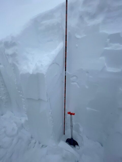
Prior to this storm, we had a shallow snowpack that saw some extended cold temps that were prime for facet development on the surface as well as near the ground: a lot of rotten or sugary snow and some variability in-depth and layering on the solar aspects and wind-loaded aspects. We heard a couple of stories of people out on Thursday in the mountains getting large whomps or collapses in the snowpack. More snow on the way Sunday will cover up a lot of Avalanche evidence, so it may take a snowpit or a quick probe...extra caution is going to be needed in the next couple of weeks as the snowpack stabilizes if any. Colder temps and more snow may help preserve weak layers and create more avalanche problems next week as another big storm cycle hits our mountains.
Media