Observation Details
Observation Date:
February 20, 2021Submitted:
February 20, 2021Zone or Region:
Big Creek SummitActivity:
Location:
Six Bit CreekSigns of Unstable Snow
Observations
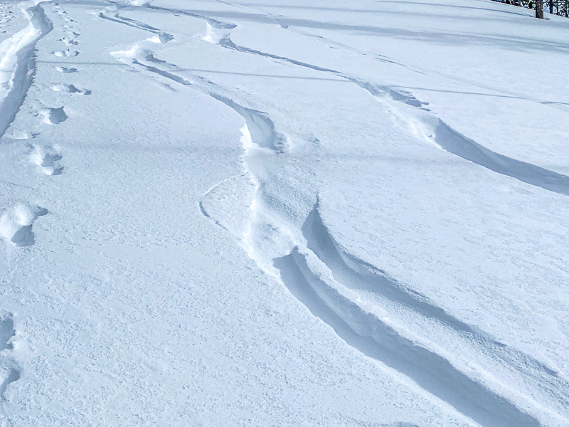
Primary Red Flags today were the new snow load (HST-8") and blowing/drifting snow (see 2nd foto). The blowing and drifting snow concerns me in that we were in a generally protected area. I would imagine that there could be significant wind slab formation in the alpine.
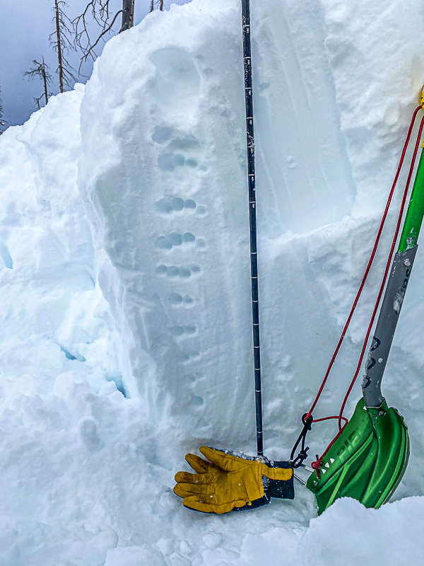
One snow pit at 6950' on a 25 degree north facing slope. HS - 210 cm.
January rain crust is 110 cm below surface - pencil hard. We did not did much below this.
We performed 2 ECTs to the rain crust with inconclusive results, typically 2 very hard to see, almost imperceptible breaks in the mid-pack in the 16-18 tap range. My take is that these are healing (slowly...) and lack energy. It's also worth noting that the graupel layer from Wednesday is a lot harder to ID than I expected. We did not get results above the rain crust like I saw last week on Boulder Mountain. However it did shear easy with a push from behind. I blame the lack of results on the fact that it was hard to isolate with a string.....my snow saw was in the car. This crust still concerns me. Overall the snow pack is right side up in this area. The glove and shovel are sitting on the rain crust in the pit photo.
It snowed about an inch during the day with some graupel.
My general take is that the snow pack is starting to heal a bit IN THIS AREA, which may not represent areas to the north as I have been seeing in the forecasts. I am treating it with suspicion.
Lots of point releases in the storm snow today, all aspects. Solar aspects were crusted on my exit this afternoon.
We are still traveling as per considerable danger. Even in mid-elevation protected areas without significant wind loading.
Toddeo - FPAC Board of Directors.
Media


